 Evolution
In Words and Images, My Hike to the Burgess Shale
Last summer my wife and I took a weeklong camping trip to the Canadian Rockies, home to some of the most famous fossils in the world — those of the Burgess Shale. What follows is an informal photo essay about my visit.
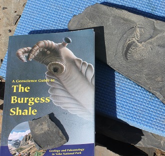
While there, we were fortunate to join a guided dayhike to the Burgess fossil quarry in Canada’s Yoho National Park. This was a real treat since I had been following Stephen Meyer’s research as he completed his new book, Darwin’s Doubt: The Explosive Origin of Animal Life and the Case for Intelligent Design.
I’ve read many scientific papers and books about the Cambrian explosion but (apart from Darwin’s Doubt!) two stand out: Wonderful Life (1989), by the late Harvard geologist Stephen Jay Gould, and Crucible of Creation (1998), by leading Cambrian paleontologist Simon Conway Morris, at the University of Cambridge. Though Gould and Conway Morris famously disagreed on how to properly classify some of the Burgess fauna, I highly recommend both books.
In his usual elegant style, Gould explains the importance of the fossils of the Burgess Shale:
Without hesitation or ambiguity, and fully mindful of such paleontological wonders as large dinosaurs and African ape-men, I state that the invertebrates of the Burgess Shale, found high in the Canadian Rockies in Yoho National Park, on the eastern border of British Columbia, are the world’s most important animal fossils. Modern multicellular animals make their first uncontested appearance in the fossil record some 570 million years ago — and with a bang, not a protracted crescendo. This “Cambrian explosion” marks the advent (at least into direct evidence) of virtually all major groups of modern animals — and all within the miniscule span, geologically speaking, of a few million years. The Burgess Shale represents a period just after this explosion, a time when the full range of its products inhabited our seas. These Canadian fossils are precious because they preserve in exquisite detail, down to the last filament of a trilobite’s gill, or the components of a last meal in a worm’s gut, the soft anatomy of organisms. (Wonderful Life, pp. 23-24)
Conway Morris also paints a vivid picture of visiting the Burgess Shale:
The Burgess Shale is a thin unit of rock. The outcrop itself, in a small quarry on the side of a hill, is rather drab and unremarkable, but any paleontologist would want to work there for two reasons. One is seemingly trivial: even if the quarry looks very ordinary, the Burgess Shale occurs in some of the most beautiful scenery in the world, in the Main Ranges of the Canadian Rocky Mountains. Looking from the quarry, as far as the eye can see, there are snow-capped mountains, glaciers, turquoise-coloured lakes, and forests set in wilderness. If one has to collect fossils, one might as well collect them here! The second reason is that the Burgess Shale is no ordinary fossil deposit. Here, by as yet largely unknown mechanisms, the process of rotting and decay have been largely held in abeyance so that the true richness of ancient life is revealed: not only are there animals such as trilobites and mollusks with tough, durable skeletons, but completely soft-bodied animals are also preserved. These remarkable fossils reveal not only their outlines but sometimes even internal organs such as the intestine or muscles. (Crucible of Creation, p. 2)
Conway Morris’s description is dead on. Imagine the scene he describes — hiking for a few hours through gorgeous scenery up to a tiny quarry where you find ancient fossils preserved in incredible detail. Needless to say, I was elated at the opportunity to hike to the Burgess Shale. I took every photo on this page — the bad shots as well as any good ones.
Getting There
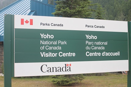
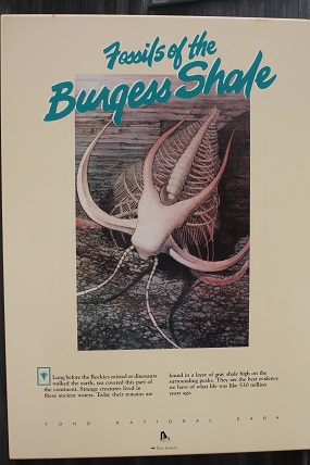
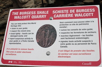
To get to Yoho National Park from Seattle where we live, it’s altogether less than a 12-hour drive. We took it slow, breaking up the journey into several days. The trip was very enjoyable: we brought our kayak and hiked or kayaked almost every day. The day before the hike, my wife and I visited the Yoho National Park Visitor’s Center in the small town of Field, British Columbia.
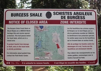
Though it’s made for the masses, the Visitor’s Center has a nice display explaining the Burgess Shale:
Field is a quaint town nestled in the Kicking Horse River Valley, which has a classic glacier-carved U-shape. The bottom of the valley is filled with detritus through which the Kicking Horse River winds its way.
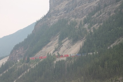
Near the town of Field are the famous spiral tunnels of the Canadian Pacific Railway, where trains travel through curved tunnels blasted into the sides of Mt. Stephen and Cathedral Mountain. Here’s a poor-quality shot of a train approaching one of the tunnels:
Yoho Valley and Takakkaw Falls
After departing the Yoho Visitor’s Center we drove northeast a couple of miles along the Trans-Canada Highway to Yoho Valley Road. From there we turned northwest, and drove about 5 miles along the floor of the Yoho Valley to Takakkaw Falls, one of the highest waterfalls in Canada. Wikipedia tells me that its highest point is 384 meters (1,260 feet) from its base, with a single cascade freefalling an impressive 254 meters (833 feet).
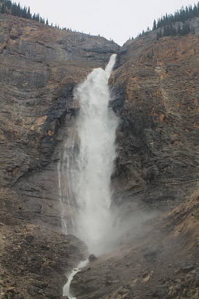
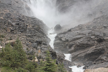
Since we were visiting in the summer, it was after peak flow from the snowmelt. Nonetheless, Takakkaw Falls creates a tremendous thunder for those standing close by.
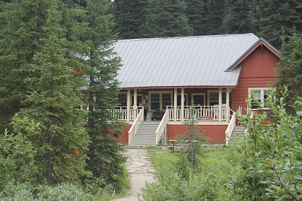
A short walk from Takakkaw Falls is the Whiskey Jack Hostel where our hike began the following morning.
The Hike to the Burgess Shale
The hike began around 9 am, but wouldn’t make it to the Walcott Quarry, the site of the Burgess Shale, until about 2 pm. We had a lot of ground to cover.
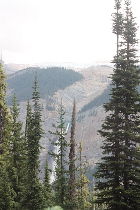
First, we hiked south, up the west side of the Yoho Valley. Here’s a shot looking back at Takakkaw Falls through the trees from up on west side of Yoho Valley:
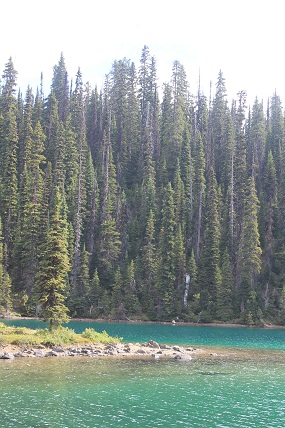
Around 10:15 in the morning we arrived at Yoho Lake, a small lake filled with ice-cold glacier water, surrounded by forest in Yoho Pass. A friend of mine tells me that in doing the same hike some years ago, he jumped into Yoho Lake. But cold water and I really don’t get along, and jumping in the lake was the last thing I wanted to do. Here are a couple of shots of this beautiful little lake:
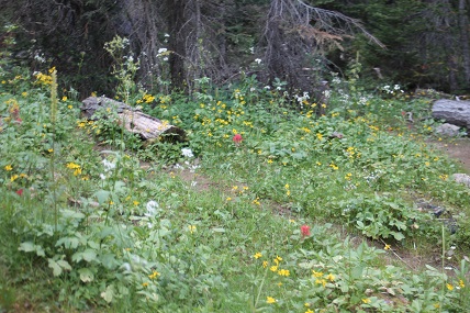
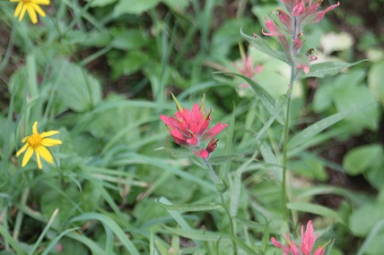
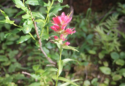
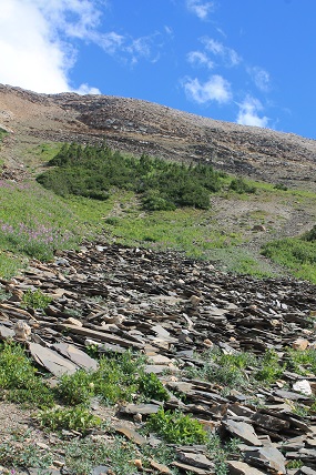
From there, we walked up a gentle incline through the Yoho Pass along a path lined with yellow, red, white, and blue wildflowers:
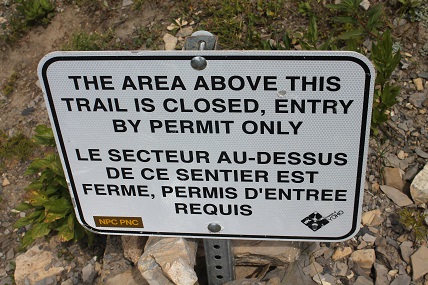
Eventually we came to a sign that indicated we were about to enter a closed area: it was the path to the Burgess Shale. You can’t go there unless you are part of a park-sanctioned, guided tour. Thankfully, we were on such a tour.
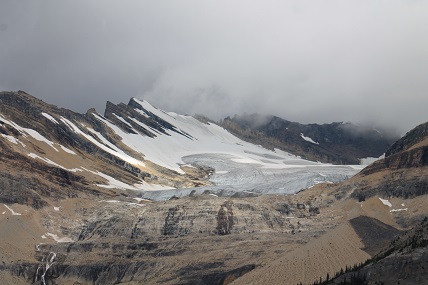
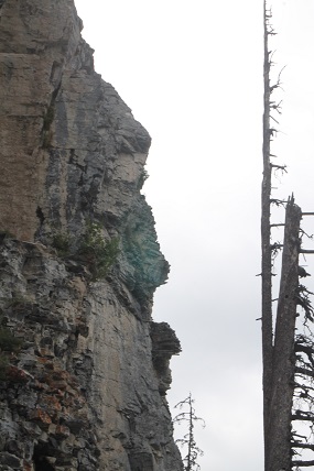
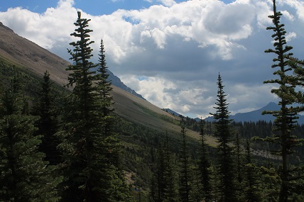
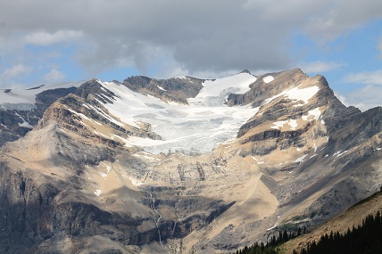
Up to this point in the hike, the elevation changes had been pretty mild. But then we started to make our way up Wapta Mountain. There were beautiful views of the Michael Glacier, melting into a waterfall going down the cliffs below:
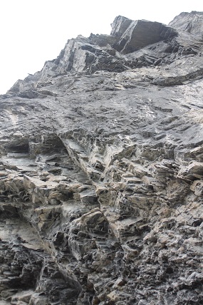
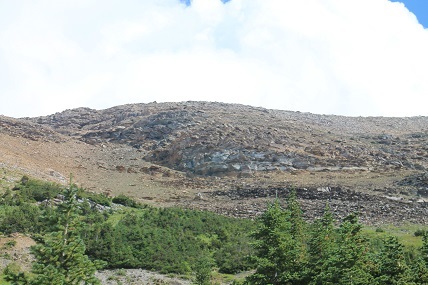
Around noon we had lunch at the north end of Wapta Mountain. Here we encountered the Eldon Formation, a unit of carbonate rocks that sit atop the Stephen Formation (the layer which bears the Burgess Shale fossils). Here are a couple of shots looking up at the Eldon Formation:
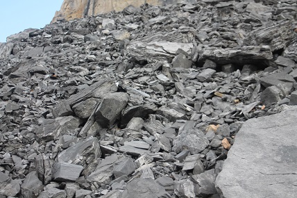
For those who love really carbonate rocks, here’s a nice shot of limestone rubble at the base of the Eldon Formation on Mount Wapta:
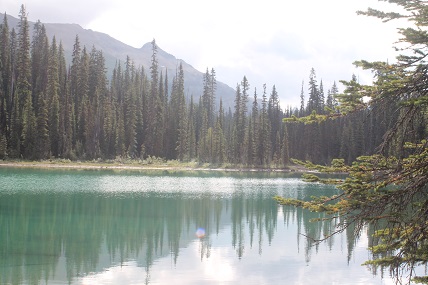
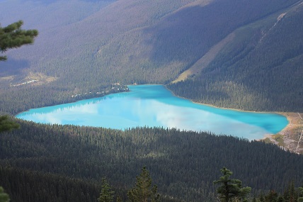
By 12:30, we were hiking along the northwest side of Wapta Mountain. From this point there were incredible views of Emerald Lake below, to the southwest:
After the hike, my wife and I debated whether to stay the night at a lovely lodge at Emerald Lake. For reasons I still don’t fully understand, we decided to camp elsewhere, in the rain, and I ended up catching a cold the next day. Oh well, back to the hike…
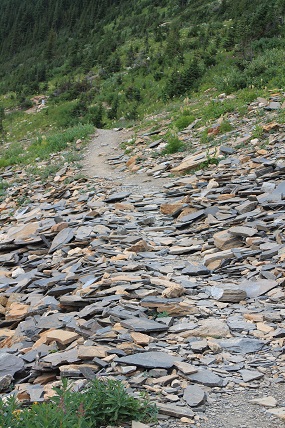
Around 1:15 pm we turned the bend around the northwest corner of Wapta Mountain and began to make our way on to the west side, hiking southward. We continued to see lots of limestone rubble which had eroded from the rock formation in the mountain above. Some of the carbonate rocks were characterized by alternating light and dark bands, seen in the photo below:
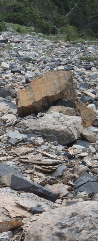
Looking back north at what we’d just hiked past, we could see the towering cliffs of the Eldon Formation at the north end of Mount Wapta:
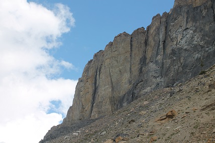
Directly above us was more Eldon formation:

By this point, we were hiking south along the west side of Wapta Mountain, seen from this shot looking ahead:
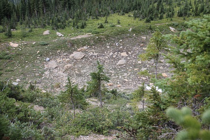
Continuing south, we passed above the site where Royal Ontario Museum researchers camped while excavating the Burgess Shale. All that remains now is a cleared area covered in rock rubble:
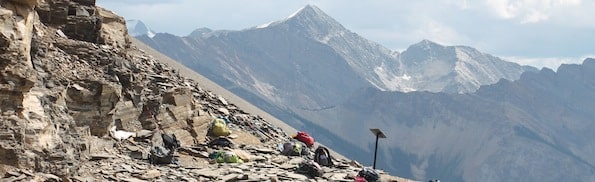
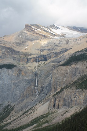
After walking south along Mount Wapta for about 30 minutes we made it to the base of the switchbacks that lead up to the Burgess Shale fossils. Here’s another beautiful photo of the Michael Glacier, seen from the west slope of Mount Wapta:
Walcott Quarry Discovery Site and Trail to the Burgess Shale Quarry
As we approached the switchbacks leading up to the Burgess Shale quarry, we walked past the famous site where Charles Doolittle Walcott first discovered the Burgess Shale fossils in 1909. We retold this story a couple years ago, but even better here is what a Nature article celebrating the 100th anniversary of the discovery of the fossils had to say:
On Saturday 28 August 1909, Walcott went up to Burgess Pass, next to Mount Field, to take photographs, and, according to his diary, “found the Stephen formation trilobite bed”. His family followed him up to the site on 30 August. The story often told is that Mrs Walcott’s horse stumbled on the important ‘discovery slab’. Instead, it seems that the man leading the packhorse train crossed over a rock that had slid onto the trail, and Walcott, concerned that his wife’s horse might trip, moved it away. The next day, he and Mrs Walcott broke up the offending slab and found “a remarkable group of Phyllopod crustaceans”. Walcott sketched three in his diary.
Walcott did not immediately realize the significance of what he had discovered. He spent just five days collecting at the site. But he returned to find the source of the discovery slab in 1910, excavating the source rock layer and making a large collection of fossils.
We walked right over this discovery site, seen in the photo below:
From there, you can look up the mountain and see the Burgess Shale quarry area above:
Around 1:40 pm, as we approached the switchbacks leading up to the final leg of the trail to the Burgess Shale, a sign reminded us that only guided hikes were allowed:
We were almost there.
The Burgess Shale Quarry
Just in case it wasn’t clear by now, as you enter the Burgess Shale Walcott Quarry you are greeted by another sign reminding you to stay with your guided tour. And of course, it’s illegal to remove fossils.
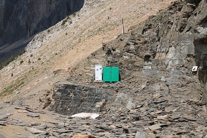
The quarry itself is only perhaps a couple hundred feet in length, and a few meters in height. The shot below was taken standing near the sign from the photo above, facing north. Most of the quarry is visible in this shot. The green and white metal cabinets at the back of the quarry contain some beautiful representative fossils and teaching tools used by the guides to teach visitors about the Burgess Shale.
And here’s a close-up of the wall on the north side of the quarry.
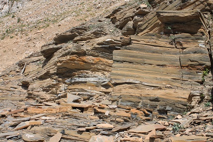
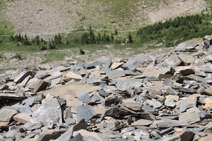
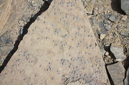
As you can see, the quarry is characterized by piles and piles of shale. Some pieces are small, some fairly large and a bit heavy. They’ve all been broken off from the rock surrounding the quarry, in many cases blasted away by dynamite.
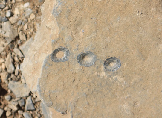
Along the eastern wall of the quarry are holes left from dynamite sticks that were used to blast away rock. Here are a few blasting holes, with a cell phone placed to show scale:
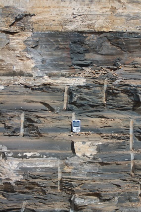
Who knows how many fossils were destroyed in the blasting process, but I suppose it’s the most efficient way to get at fresh rock races.
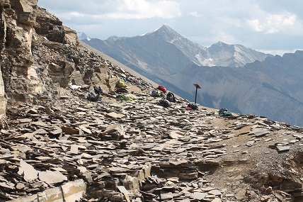
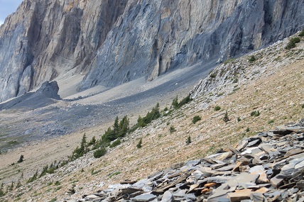
The shot below shows how the quarry is above the tree line, in an area that is mostly devoid of vegetation. Much further down the mountain are shrubs and then trees, visible in the distance.
Here’s the south end of the Burgess Shale quarry, looking off into the distance:
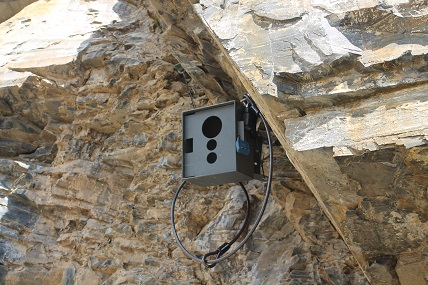
We saw what appeared to be cameras mounted at the quarry to keep an eye on visitors, to make sure they did not steal fossils:
Here’s a shot looking north back up the west slopes of Mount Wapta, with some piles of shale in the bottom right:
Burgess Shale Fossils
And now, what you’ve been waiting for: photographs of fossils from the Burgess Shale!
As I mentioned, removing fossils from the quarry is strictly forbidden. These fossils are too important to be possessed by any single person.
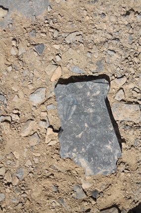
Nonetheless, we were allowed to freely take pictures, and to carefully pick through the shale. While the vast majority of shale fragments did not contain fossils, it wasn’t very hard to find occasional ones that did. Trilobites and priapulid worms were perhaps the most common fossils we found. But with a little searching I was also able to find many fossils of limpet-like mollusks called Scenella, a few brachiopods, possibly an Eldonia-like fossil, and a few others I couldn’t identify. People would typically set interesting fossils out to the side at the quarry so that future visitors could look at them and appreciate the fossils.
Fossils We Found at the Burgess Shale Quarry
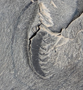
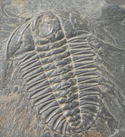
Trilobites
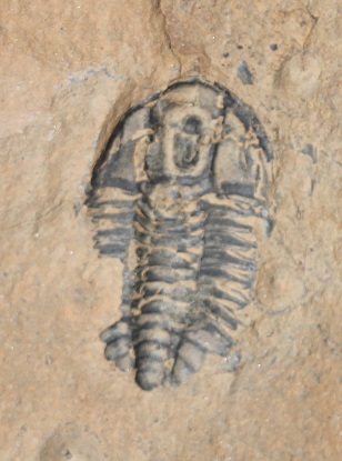
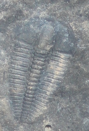
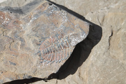
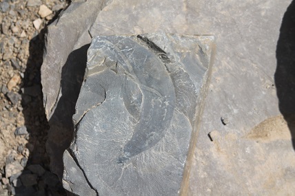
I’ll start with some photos of fossils we found that many readers will recognize: trilobites:
I probably should have included an object for scale in some of these photos. The trilobite below is actually quite small, probably only a few cm in length:
To appreciate its small size, here’s the same shot without the trilobite cropped, giving a nice feel for how these bugs were just sitting out on pieces of shale on the dirt:
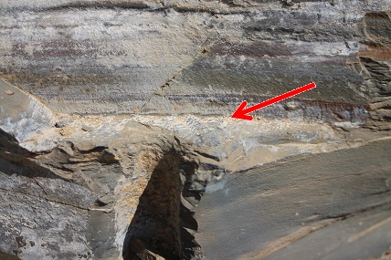
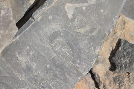
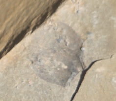
This trilobite below is an interesting one, although unfortunately it is very difficult to see in the picture. This piece of shale isn’t sitting on the ground — it’s part of the eastern rock wall of the quarry. The trilobite is on a horizontal piece of rock attached to, and jutting out, from the wall — so the trilobite (indicated by the red arrow) looks like it is swimming out of the wall:
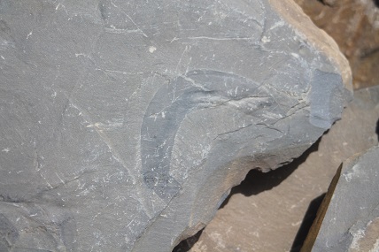
Many of the trilobite fossils were incomplete fragments, like this one below:
Another small trilobite:
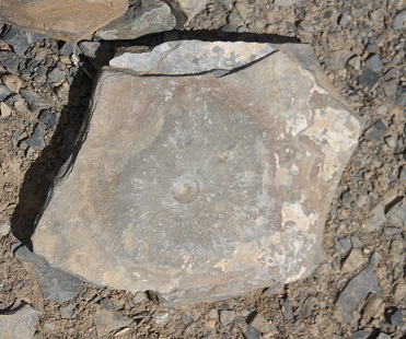
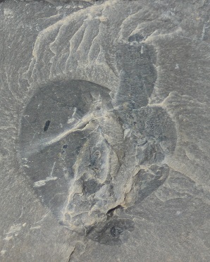
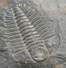
This specimen is probably the most beautiful trilobite fossil we found out among the rocks:
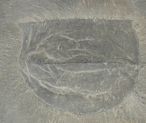
Ottoia
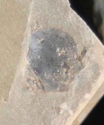
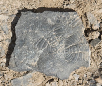
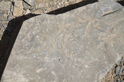
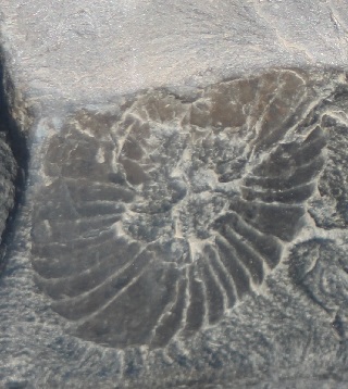
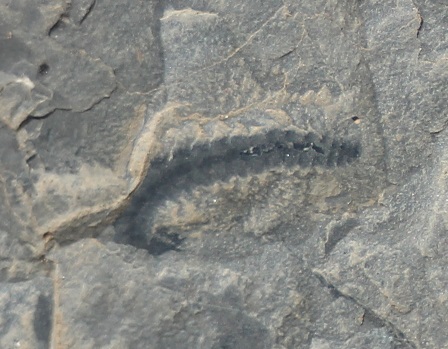
As I mentioned, many of the fossils we found at the quarry were priapulid worms of the genus Ottoia prolifica, so named because they are very common in the Burgess Shale. As I discussed on ENV last year, Ottoia fossils show that the priapulid body plan has essentially not changed from 505 million years ago to the present. Here are some of the nicer specimens we found:
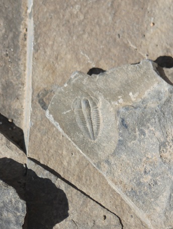
Scenella
Another great example of “stasis” is Scenella, a mollusk that looks pretty much exactly like limpets you’ll find growing in tide pools or on seawalls today. We saw many examples of Scenella as well:
Here’s a close-up of three Scenella fossils:
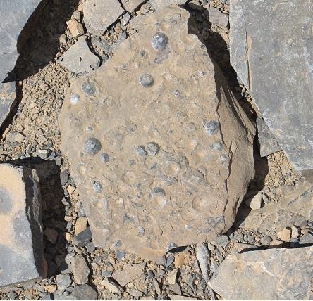
Here’s a slab bearing numerous Scenella fossils:
Brachiopods
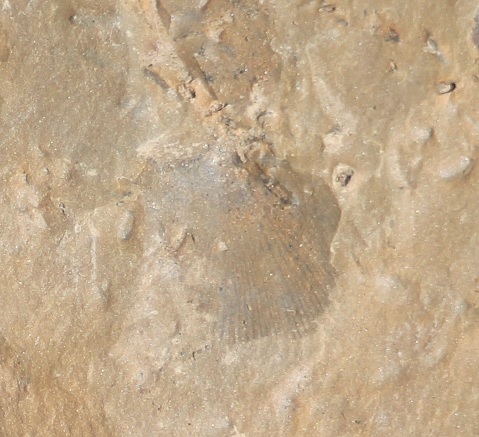
Near the end of our time at the Burgess Shale, I turned over a couple pieces of shale at the north end of the quarry, and discovered a few small shelled fossils that looked astonishingly like modern brachiopods:
Finally, there were a few fossils I could not identify:
Specimens Stored at the Burgess Shale:
As I mentioned, there are some prime fossil specimens kept in storage at the Burgess Shale site. Our guide got them out and was kind enough to explain them to us and let us take pictures.
Anomalocaridids
Some of the most notorious fossils from the Burgess Shale are anomalocaridids — some reached up to a length of 1 meter, making them the largest predators of the Cambrian seas. This fossil shows the claw of an Anomalocaris:
This claw was used to shovel food into the menacing mouth of Anomalocaris:
Individually you might not think these fossils belonged to the same organism. But other fossils have shown what a fully assembled Anomalocaris looks like. So putting the pieces together, here we see the claw next to the cover of a book that shows how it was used for feeding:
Unfortunately they didn’t have a complete Anomalocaris fossil up at the quarry.
Burgessochaeta
Here’s a specimen of the polychaete annelid worm, Burgessochaeta, a moderately common fossil in the Burgess Shale:
Canadaspis:
Here’s a nice shot of a fossil Canadaspis, a Burgess arthropod, possibly a crustacean:
It’s very hard to imagine what it might have looked like in life — but some online reconstructions give an idea of this creature’s body plan.
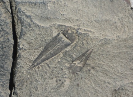
Haplophrentis:
Haplophrentis was a Cambrian hyolith, a small creature with a conical shell, which probably lived in the mud along the seabottom:
Leanchoilia:
Leanchoilia was yet another Cambrian arthropod, famous for its long whiplike frontal appendages (though they can’t be seen here). Stephen Meyer has some spectacular color photographs of this species from the Chengjiang biota of China in his book Darwin’s Doubt. But before the Chinese fossils were discovered, this creature was already known from the Burgess Shale. Here’s a photograph of a specimen we were shown:
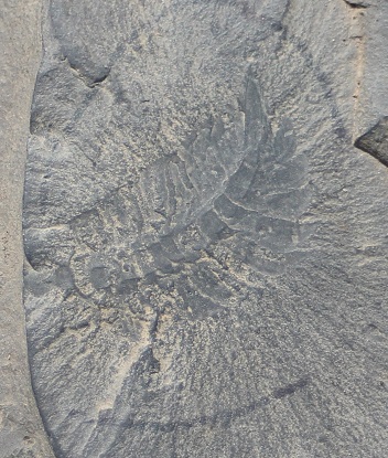
Sidneyia
Sidneyia was another arthropod known from the Burgess Shale, one of the largest arthropods found in that locality:
The species was named after Charles Doolittle Walcott’s son, Sidney.
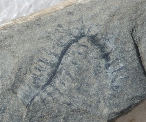
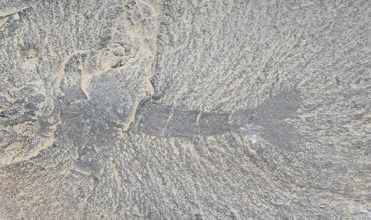
Stephenoscolex
Stephenoscolex was another type of polychaete worm known from the Burgess Shale. This specimen is very small — only a couple cm in length:
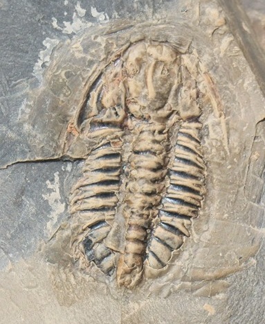
Trilobites
We’ve already seen some spectacular trilobite fossils, but in addition there were some very nice ones separated out for visitors to see:
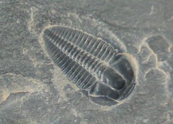
This one is of genus Elrathia, a very common species:
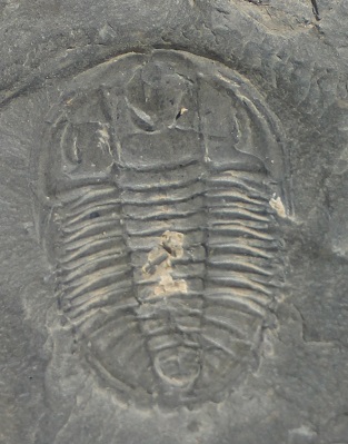
These two are of genus Olenoides, another very common species:
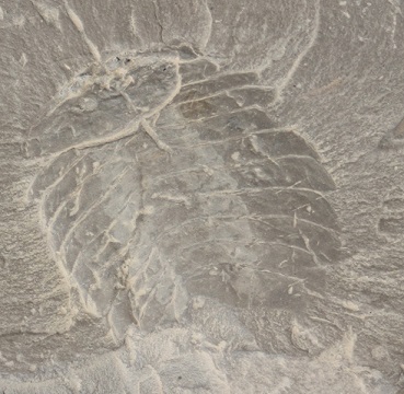
Tuzoia
Tuzoia was a large arthropod from the Burgess Shale:
Many specimens of Tuzoia, this one included, are missing many body structures, making it more difficult to classify. Thus, though it doesn’t look like much here, check out some reconstructions online for a better idea of its likely morphology.
Waptia
Waptia was a shrimp-like arthropod.
Many fossils of Waptia are more complete than this one, showing its carapace and legs. There are some beautiful photographs of specimens of Waptia in Darwin’s Doubt, but again some reconstructions online will give a better idea of what it looked like.
What Lies Beneath
After spending a little over an hour at the Burgess Shale we headed back down the mountain. Naturally, going downhill takes less time, so we were back at the Whiskey Jack Hostel by 5 or 6 pm. This means we covered a total of about 13 km (8 miles) in 8 or 9 hours — a pretty easy pace, which most in our group probably appreciated given that the Burgess Shale outcrop sits at about 7,500 feet elevation.
In any case, this guided hike — and the photos I took — have provided me with memories I’ll keep for a lifetime. Of course the reason these fossils are hallowed isn’t simply because they’re spectacularly preserved fossils, but because they represent the beginning of animal life in the fossil record. What makes them even more important, far beyond the fossils themselves, is what lies beneath them in the record: that is, precious little of any description and nothing at all by way of ancestors. Below the Cambrian strata, there are no direct evolutionary precursors of the Cambrian fauna. Even Richard Dawkins admits they look as if “they were just planted there without any evolutionary history.”
Neo-Darwinian theory cannot account for their existence. So why are they there? Indeed, why are we here? For the amazing full story, read Stephen Meyer’s newly released Darwin’s Doubt: The Explosive Origin of Animal Life and the Case for Intelligent Design.